(Collage by Joy Olivia Miller)
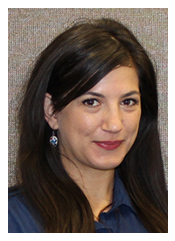
Below: Taylor Hixson. (Photography by Rachel Rosenberg)
Librarian Taylor Hixson discusses digital mapping in the academy and beyond.

Cartography once required the painstaking creation of physical maps by hand. Today anyone with an internet connection can be a mapmaker. Advancements in
geographical information systems (GIS)—systems that store, manipulate, and present geographical data—have transformed maps from static images to dynamic representations that can be constructed and refreshed with the click of a button. Mapmaking has never been so widespread or so sophisticated.
The
Magazine spoke with
Taylor Hixson, who was appointed resident librarian for GIS at the University of Chicago Library this past fall, to learn how this technology is transforming theory and practice in several domains.
Hixson helps students, faculty, and staff integrate GIS into their projects, identify GIS resources, and organize data sets. She provides both one-on-one and classroom instruction, while fostering collaboration on campus.
Her comments below have been condensed and edited.

How does GIS force us to rethink traditional issues in cartography? What questions remain the same?
What remains the same may be simpler to answer first: People still want to use maps to find out how to get somewhere and what landmarks or geological features may be at a location once they arrive.
In terms of rethinking traditional cartography, GIS has caused us to not think about cartography. Apps and online tools often allow users to be the mapmaker, which can be good and bad. When anyone can be the mapmaker, the product may look the same as a professionally produced map, but the data integrity and authority may not be. On a similar note, people are now freely giving away their exact locations through geo-tagging and consequently giving up their own privacy without realizing it or understanding the implications of doing so.
You worked as an intern for the US Department of State. How did this experience illustrate the humanitarian potential of GIS?
In the United States or other developed countries, we often take for granted that we can go to a search engine, type in the name of where we want to go, and have directions that are accurate within 30 feet. But this isn’t true for all of the world. Much of the developing world still is not mapped. Humanitarian volunteers can make a major impact through a simple action like finding coordinates through Google Maps or OpenStreetMap that are then distributed to aid workers and coordinators who can help people find access to health care.
GIS calls to mind science and big data, and yet digital humanities has become a major trend. How do you see humanists using GIS at UChicago?
Humanists at UChicago can use GIS in an almost limitless number of ways. GIS can help humanists provide further context to any existing research that may deal with concepts of space and place. They can add a layer of spatial data by piecing together place names or geographic information from narratives and other primary sources to create a clearer picture of how people may have moved through society. I recently worked with the history department's Mellon career development officer to host a workshop on GIS for the history PhDs, which I really enjoyed.

 Cartography once required the painstaking creation of physical maps by hand. Today anyone with an internet connection can be a mapmaker. Advancements in geographical information systems (GIS)—systems that store, manipulate, and present geographical data—have transformed maps from static images to dynamic representations that can be constructed and refreshed with the click of a button. Mapmaking has never been so widespread or so sophisticated.
The Magazine spoke with Taylor Hixson, who was appointed resident librarian for GIS at the University of Chicago Library this past fall, to learn how this technology is transforming theory and practice in several domains.
Hixson helps students, faculty, and staff integrate GIS into their projects, identify GIS resources, and organize data sets. She provides both one-on-one and classroom instruction, while fostering collaboration on campus.
Her comments below have been condensed and edited.

