
(Illustrations by Ben Giles)
From the Atlantic to the Pacific, an alumna takes the measure of Route 20 and points along the way.
If I stand in the road in front of my house and gaze north, a traffic light glows where historic US Route 20 travels east and west through northeast Ohio, a few miles south of Lake Erie. I live on County Line Road, and if I cross the road into Ashtabula County, I’m officially in Appalachia. Four buildings mark the corners of the intersection.
Northwest: an Italianate mansion behind a chain-link fence on the grounds of Ridge Manor Nursery, over 300 acres topped with gravel and plastic pots of uniformly pruned landscaping plants, like arbor vitae and hydrangea, grown for a large garden center chain.
Northeast: a store called Corner Store, selling a limited supply of staple goods but a decent array of hot sauces, where the cashier converses in Spanish with workers from the nursery and in English with me.
Southeast: a church in a ranch house with a sign saying
“Gods Tabernacle,” though it is not polytheistic but Pentecostal.
Southwest: The Pub, a small bar with 75-cent wings and buck-fifty beers and bigger crowds than the church.
Route 20 stretches 3,365 miles from Boston, Massachusetts, to Newport, Oregon—the longest road in the United States. When I think of it spanning the country, I imagine a seam holding the land together, or a zipper ready to separate it, or perhaps a measuring tape.
Measure twice, cut once: the mantra of a careful craftsperson. As a kid I spent hours watching my mom sew, the presser foot on her Singer 237 Fashion Mate machine guiding the needle along its smooth stitches. The space between the stitches and the edge of the fabric is the seam allowance. A store-bought pattern accounts for the seam allowance, but if you’re designing something from scratch, you need to be sure to include the extra space before you cut out your pieces. Without a sufficient allowance, the fabric could pull loose of the stitches, leaving a hole along the seam.
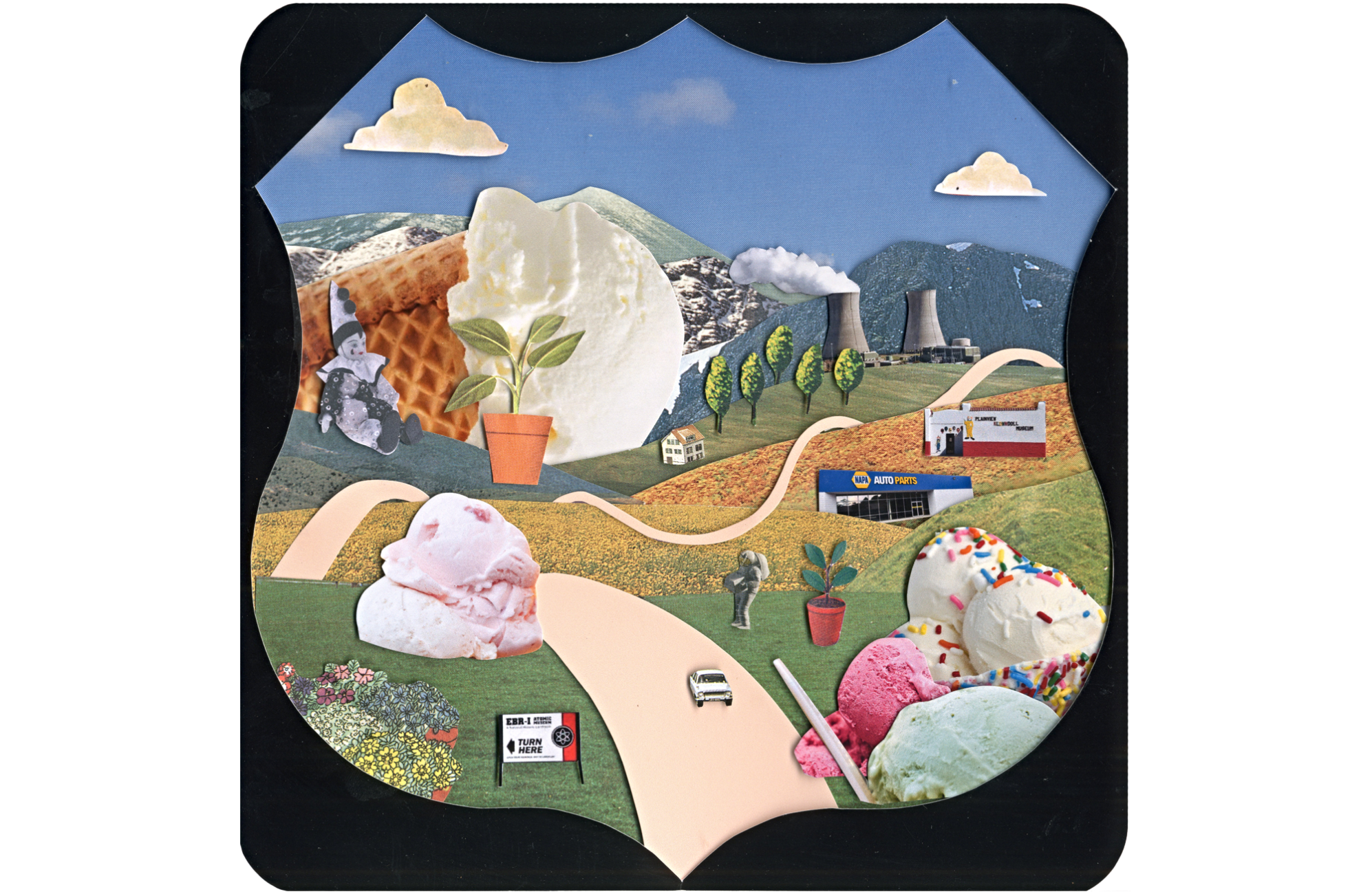
Along Lake Erie, the shoreline and Route 20 are mostly separated by other roads. However, for one brief stretch less than 10 miles west of my intersection, the only thing between the highway and lake is the 1,100-acre property of the Perry Nuclear Power Plant, its twin 516-foot-tall hourglass cooling towers looming near the shore. I live within the emergency planning zone, so the county health department issues me potassium iodide pills to take in case things go wrong.
The plant was originally meant to have two reactors, but in 1988, only a year after commercial production began, power demands changed, and work on the second unit was never completed. The two towers give the illusion of a larger plant, but only one pumps steam into the troposphere—the nonfunctioning tower remains as an artifact of miscalculation.

About 45 miles west of my intersection on Route 20 sits Public Square, the heart of downtown Cleveland. On Cleveland’s east side, Route 20 is Euclid Avenue, which runs along the campuses of Cleveland Clinic and University Hospitals. Eighteen years ago I received a blood transfusion in the emergency room at Cleveland Clinic, just south of Route 20. Lying on the gurney, I imagined the people who donated the units of O-negative blood I needed: folks who wandered into a blood drive, signed their forms, climbed onto a donation bed, and let the very same blood that was entering my veins leave theirs.
In the past year I’ve spent some time at University Hospitals Seidman Cancer Center with a friend who, at 35, was diagnosed with triple-negative breast cancer. The infusion therapy suite, a modern glass atrium where chemotherapy patients receive their treatments, looks out over Route 20. One rainy day, while my friend reclined under a warm blanket with her IV, outside on the sidewalk a man wearing shorts and a see-through plastic rain poncho whizzed past our window on Rollerblades, weaving around pedestrians making their way to the bus stop.
If Route 20 were a border, it would slice the country into two pieces, though I’m not sure where Alaska or Hawaii would fit in. Because I’d dwell on the border, some of my neighbors would be foreigners, our lives separated by documents, checkpoints, suspicions, and suspiciousness.
When driving down Route 20 last fall, noticing election signs that had popped up over the summer, I considered that this is a country divided by opinions and beliefs but united by roads. And united by roads, we’re subjected to the same detours. One and a half miles east of my intersection, Route 20 has been closed to eastbound travelers for months as crews replace storm and sanitary sewers and remove the remnants of an old trolley system. The construction obscures an Ohio historical marker erected at the birthplace of R. E. Olds, who introduced the stationary assembly line to auto production, the precursor to Henry Ford’s moving assembly line. The historical marker pokes up from the empty parking lot of a vacant building that was once a NAPA Auto Parts store. Westbound traffic creeps beside orange barrels and steel plates.
On an early morning in mid-July 2024, I drive Route 20 eastbound on the South Side of Chicago, where it follows 95th Street/Stony Island Avenue and turns south just before Calumet Park, skirting the East Side neighborhood. Usually I cruise above this area on the Chicago Skyway, the first privatized toll road in the United States, owned currently by Canadians and Australians. Storefronts along Route 20 sell tortas y tacos and auto repairs, but one also houses the Centro de Trabajadores Unidos, whose vision is to build “a healthy and thriving local economy free from exploitation and oppression.”
After slipping under the Skyway, Route 20 eases into Indiana, bisecting 1,400 acres of huge squatting white tanks and pipes and stacks of the BP Whiting refinery. According to the BP US website, each day the refinery produces enough fuel for the average daily travel of over seven million cars. Six months before, a power outage at the refinery caused Route 20 to shut down as huge flames flared from stacks and filled the surrounding area with smoke.
Further along Route 20, in East Chicago, Indiana, I find a “road closed” sign blocking the street. On this day, Route 20 is also closed in Sisters, Oregon; Long Pine Recreation Area, Nebraska; Galena, Illinois; Geneva, Ohio; and North East Township, Pennsylvania. Otherwise, it appears to be serving its purpose.
Route 20 was once a thriving artery bringing goods and vacationers east to west, but the interstate highway system made these trips faster, and the ghosts of tourism haunt the route near where I live—mid-century motels and strips of tiny cabins, some now converted to apartments. Empty buildings mark services no longer in much demand, like clock repair and alterations. Elsewhere, the road innovates, revises, shapes itself to our tastes and values, finds ways to extend our journeys, to sidetrack us.
In Orchard Park, New York, Route 20 Ice Cream inhabits an old Texaco Sky Chief gas station. In Cazenovia, New York, a Masonic lodge runs Nelson Creamery. In Conneaut, Ohio, a former church houses Heavenly Creamery. In Plainview, Nebraska, free admission gets you inside the Klown Doll Museum with over 8,000 clown dolls. In West Yellowstone, Montana, at Grizzly and Wolf Discovery Center, $16.50 allows you close proximity to bears and wolves and (for the more timid) ground squirrels. In Rexburg, Idaho, for $139.95 a carload you can drive through Yellowstone Bear World and visit the petting zoo and amusement rides; for $75 more, you can bottle-feed a bear cub. Further west, in Sisters, Oregon, you can stop by the Fantastic Museum (admission: donation only) and take in the presence of the nine-foot-tall, purported Norwegian mummy Olaf the Giant. Once exhibited at the Barnum and Bailey Circus and the 1962 Seattle World’s Fair, he now rests on rust-colored velvet in a glass-topped case.

Driving across Idaho on our way to scatter my mother-in-law’s ashes, my husband and I find ourselves outside of Atomic City, Route 20 stretching miles through dry sagebrush grasslands. A modest sign advertises the EBR-1 Atomic Museum. I’ve been interested in nuclear history ever since I lived in Snell-Hitchcock Hall as an undergraduate at the University of Chicago in the early 1990s; the view across 57th Street featured the bulbous bronze-black shine of Henry Moore’s sculpture Nuclear Energy at the site of Chicago Pile-1, where the first human-made self-sustaining nuclear chain reaction took place December 2, 1942, on a squash court beneath the University’s abandoned Stagg Field. Apparently Enrico Fermi stayed in Hitchcock while working on the Manhattan Project.
We pull off 20 to the windowless brick building housing the experimental breeder reactor that on December 20, 1951, was the first to produce usable electricity, powering four lightbulbs and then the whole building. In the control room of the reactor, the switches, dials, meters, and buttons that once controlled the reactor invite visitors to touch. I reach for the button labeled SCRAM—worn to a coppery shine by a parade of fingers—and push; I imagine the emergency shutdown.
About nine miles east of the exit to EBR-1 sits the site of SL-1, where an experimental nuclear reactor exploded in 1961, killing three technicians. One of the technicians pulled a control rod too far out of the reactor, which reached supercritical almost instantly. The radioactive bodies of the technicians were buried in lead-lined caskets.
It’s midsummer 2024, and along Route 20 in Oregon, three large wildfires and a number of smaller fires, started by lightning strikes, burn over 400,000 acres. Two of these fires, including the largest, the Durkee Fire, are 0 percent contained. In the weeks ahead, firefighters will get the fires under control, but right now, people are being told to evacuate. In photos, a line of flame and black smoke marks where the fire steadily consumes the dry, sage-spotted land.
Around 2,242 miles east, my friend and I are back in the infusion suite. We listen to the clicking of the pump dripping chemo through the implanted port in her chest. I’m confused and amazed by the power of the MRIs, the CT and PET scans, to see inside a body, beyond skin and skull, to pinpoint aberrations. In a few weeks, she’ll undergo whole-brain radiation therapy to reduce tumors in her brain; she will begin new treatment plans—her path forward unknowable and persistent.
Recent construction both east and west of my intersection slows and complicates my usual errands but allows me to see the layers of asphalt and concrete, and the rocky soil predating the road. Of course, Route 20 as it exists is an iteration of older trails once followed by Native Americans. As long as there have been trails, there have been ways to measure trails—paces, miles, kilometers. But my favorite way to gauge distance is the least accurate: time. Depending on how fast we go, how often we stop, we may never get a consistent number to understand our progress.
Though the official length of Route 20 is 3,365 miles, some argue that this distance is inaccurate. For instance, the 92 or so miles of the road through Yellowstone National Park aren’t officially Route 20; no numbered highways exist in the park. I wonder why and discover a National Park Service document from 1984 titled Park Road Standards, which includes such information as the minimum radius needed for a U-turn. The typewritten introduction, “The Purpose of Park Roads,” explains that the fundamental purpose of the parks is “bringing humankind and the environment into closer harmony” and that the “distinctive character of park roads plays a basic role in setting this essential unhurried pace.” Park roads “are designed with extreme care and sensitivity with respect to the terrain and environment through which they pass—they are laid lightly onto the land.” It states that no road in a park should be “planned or designed merely as a device to link points of interest.”
I think about this. The road in Yellowstone is not intended to be a continuation of Route 20, but, instead, an interruption of it, a pause or detour from getting places promptly—a communion with the land not measurable by any usual means. Park Road Standards quotes an old park service brochure: “If you are in a hurry, you might do well to take another route now, and come back when you have more time.”
Approximately 2,032 miles from my intersection, I make a sandwich beside the parking lot of Craters of the Moon National Monument, surrounded by picnicking families also making sandwiches. The park was officially named in 1924; humans didn’t explore the moon for another 45 years. In 1969 the lava formations and cinder cones served as training grounds for NASA astronauts, including Eugene Cernan, who would later command the 1972 Apollo 17 mission. It was on that mission that the iconic “Blue Marble” photo of Earth, beloved by environmentalists, was taken by one of the three astronauts, though we don’t know who clicked the shutter. As though to illustrate their shared expedition, each claimed to have shot it. The day it was taken, astronaut Harrison Schmitt (who would years later deny human impact on climate change) commented, “I’ll tell you, if there ever was a fragile-appearing piece of blue in space, it’s the Earth right now.”
At the end of their stay on the moon, Cernan ascended the ladder off the surface for the last time, saying, “We leave as we came and, God willing, we shall return with peace and hope for all mankind.” Though a return mission is scheduled for September 2026, we have, for now, never journeyed back.
Progress is measured in indices and percentages, in deadlines and achievements, in distances and profits. I wonder how to measure the durability of what holds us together, the allowance necessary to be sure that seam doesn’t give way, doesn’t split.
On a sewing machine, two threads create a stitch: one coming from the top and one from the bottom. On an ideal stitch, they meet in the middle of the fabric layers’ thickness and wrap around each other. However, if the tension of either thread is too strong or too weak, the stitch will be out of balance and may not hold, one thread lying flat across the surface, marked by loops of the other thread popping up. Instead, this is how a seam should be: both threads bobbing equally in and out of the material as the needle sews forward, evenly secured, a simple but reliable bond.
Mary Quade, AB’93, is the author of Zoo World: Essays (2023, The Ohio State University Press/Mad Creek Books).